Real Evidence
See it in action.
Multi-source geospatial analysis: satellite and drone imagery of Guntur processed in the Spatial Intelligence Workbench
Complete geospatial environment: GIS analysis, remote sensing, point cloud processing, terrain modelling, and AI-powered spatial analytics.
Capabilities
Sentinel-2, Landsat, commercial satellite imagery processing via GDAL/OGR 3.8. Multi-spectral, SAR, and optical analysis.
QGIS 3.34 + PostGIS 3.4. Buffer, overlay, dissolve, spatial join, topology, and geostatistical operations.
DEM/DSM generation from photogrammetry and LiDAR. Contours, viewshed, and hydrological modelling via GRASS GIS 8.3.
PDAL + CloudCompare. Billions of points — filtering, classification, segmentation, and surface extraction.
AI-powered change detection (Guntur POC: 10,611 buildings analysed). LULC classification on NVIDIA A10 GPU.
Publication-ready maps with legends, scale bars, north arrows. Export PDF/PNG/SVG. WMS/WFS publishing via GeoServer.
Real Evidence
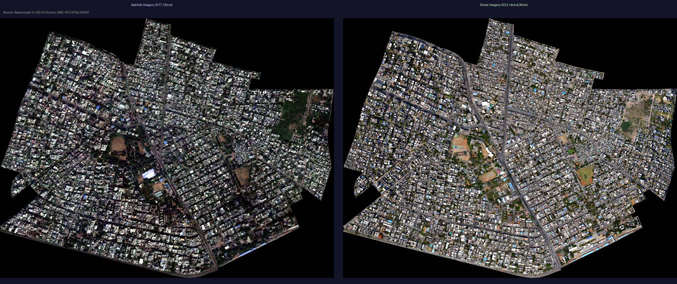
Multi-source geospatial analysis: satellite and drone imagery of Guntur processed in the Spatial Intelligence Workbench
Use Cases
Compare multi-temporal Sentinel-2 imagery to identify new construction, demolition, and modification — as demonstrated in the Guntur POC (10,611 buildings analysed).
Supervised LULC mapping from multi-spectral imagery. Train custom classifiers on A10 GPU and export GeoTIFF + vector boundaries.
Process UAV image sets through COLMAP → dense point cloud → DEM/DSM → contour extraction via GRASS GIS pipeline.
Sentinel-1 SAR backscatter analysis for flood extent delineation, water body change, and inundation frequency mapping.
Automated vegetation encroachment detection along pipeline, railway, and power line corridors from satellite time-series.
Hot-spot analysis, spatial autocorrelation, and kernel density estimation on millions of features via PostGIS + GPU acceleration.
From intent to verified engineering artifact.